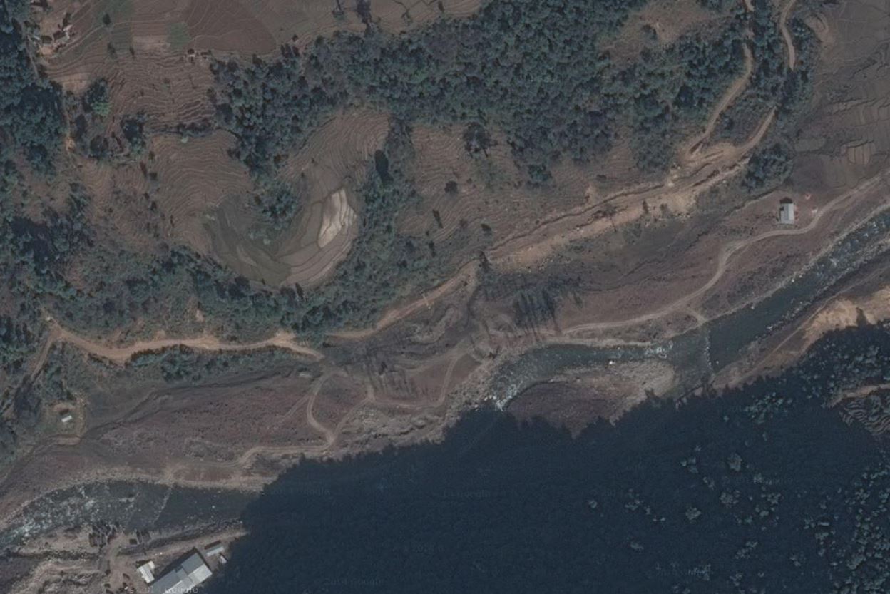
Landslides and Road Blocks
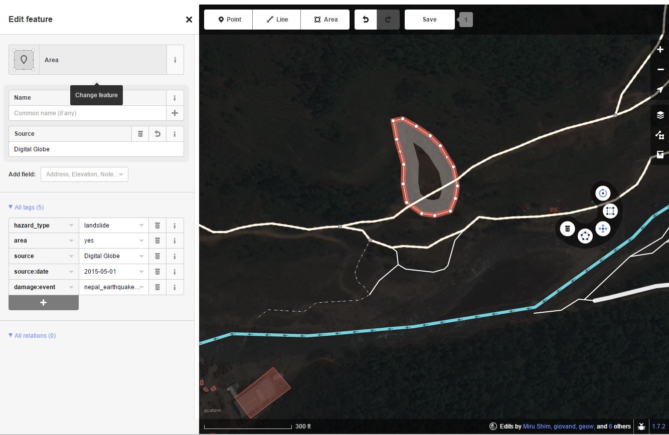
Area feature
Objects to map:
- landslide cones (area covering the entire landslide, use hazard_type=landslide)
- landslide locations (node, point within the landslide cone area, use hazard_type=landslide)
- road blocks caused by landslide debris (node, use barrier=debris)
- roads damaged or blocked by landslides (way, use smoothness=impassable)
Landslides (node or area)
hazard_type=landslide
source:date=add date of imagery per task
source=add appropriate source per task
damage:event=nepal_earthquake_2015
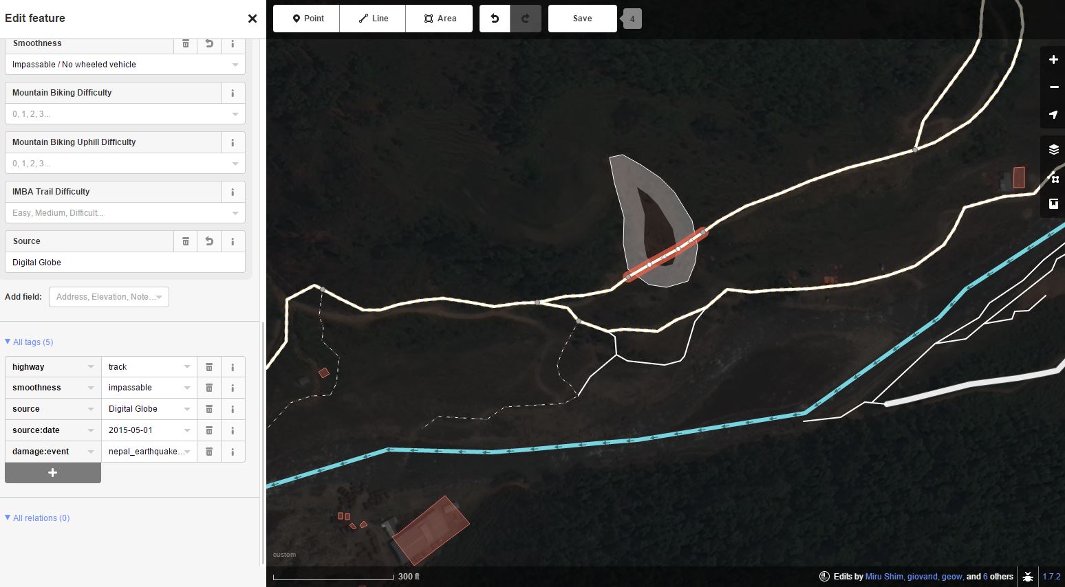
Blocked/damaged roads (way)
highway=*
smoothness=impassable
source:date=add date of imagery per task
source=add appropriate source per task
damage:event=nepal_earthquake_2015
Road blocks (node)
barrier=debris
source:date=add date of imagery per task
source=add appropriate source per task
damage:event=nepal_earthquake_2015