Classifying Roads
All roads are classified as some type of highway. Roads are primarily classified based on their function. After drawing a line using iD editor you will select the  button, then you will see the different road classifications. On your right you will see the main types of roads you will typically classify. These are listed below. If you aren’t sure what road classification to select, choose Minor/Unclassified Road.
Residential Road

Roads which serve as an access to housing, without the function of connecting settlements. These are often lined with housing.
Primary Road

A major highway linking large towns
Secondary Road

A highway which is not part of a major route, but nevertheless forms a link in the national route network.
Tertiary Road

A road connecting smaller settlements, or a road within large settlements that connect local centers.
Minor/Unclassified Road

A minor road of a lower classification than tertiary, but which serves a purpose other than access to properties. These often link villages and hamlets. (The word ‘unclassified’ is a historical artifact of the UK road system and does not mean that the classification is unknown.) Choose this option if you are unsure what to classify a road as.
Attribute: Surface
In addition to using the highway tag, you can indicate the physical surface of the road with the surface tag:
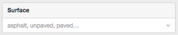
Generically, a hard surface (asphalt, cobblestone, concrete…) can be indicated with paved and a soft one (ground, sand…) with ‘unpaved’.