Areas as points of interest
Areas as pionts of interest
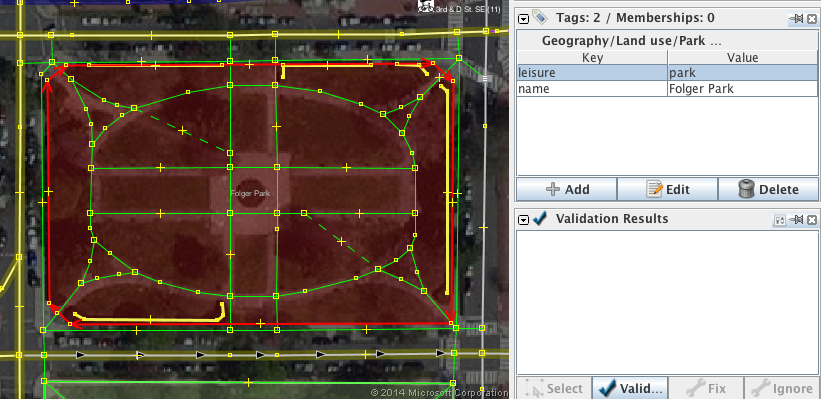
Wherever you can clearly determine the extent of a “point” of interest, map it. A good example are parks, here is Folger Park in Washington DC. The Park is mapped as a closed way tagged leisure=park. Note how the way follows the exact outline of the park.
