Example: solar panels in Freetown
This example follows one finished production project from the imagery to a training dataset. Volunteers looked for rooftop solar panels in drone imagery of Freetown, Sierra Leone. The values below come from the project page and its public exports.
Files
| File | What it is |
|---|---|
| Area of interest | The rectangle uploaded to the project, about 2.8 km by 1.4 km |
| Cover image | The project's cover image |
| Processed tasks | The 2,964 project tiles, built from the project's Tasks export, for the tutorial builder |
| Aggregated results | The project's Aggregated Results export |
| Cells at 50% | The cells marked by at least 50% of volunteers, downloaded from the results map |
| Results training dataset | A YOLO oriented bounding box dataset from the auto labeller, with labels.geojson and a README.md for QGIS |
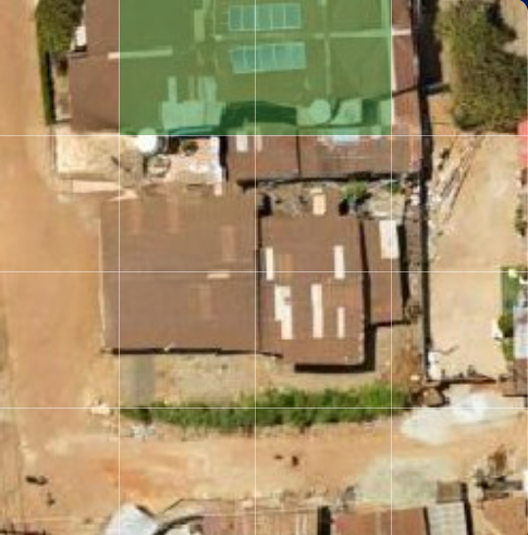
Project settings
| Field | Value |
|---|---|
| Project type | Locate Objects |
| Project name | Locate Objects - Locate Solar Panels Freetown - Sierra Leone (3) HOT |
| Project description | Please help us to locate solar panels in Freetown to train AI |
| Project region | Sierra Leone |
| Organization | HOT |
| Imagery | Freetown Urban with Sensitive Areas Blurred on OpenAerialMap: DroneTM, DJI Mini 4 Pro, 22 October 2025, about 4 cm per pixel, CC-BY-4.0 |
| Zoom level | 20 |
| Sub-grid size | 4x4 |
| Multiple Features | Left out: the results don't have a 2_count column, since the results list one column per answer the project offers (source) |
| Verification number | 20, the number_of_users_required of every group in the Groups export |
| Groups | 39 groups, each 3 tiles tall and 24 to 26 tiles wide |
The instruction, Look for, Export Meta, the group size setting and the tutorial are not on the public project page or in its exports.
The project used this tile URL:
https://2glp8ghj65.execute-api.us-east-1.amazonaws.com/cog/tiles/WebMercatorQuad/{z}/{x}/{y}@1x?url=https://oin-hotosm-temp.s3.us-east-1.amazonaws.com/690585b76415e43597ffd7ea/0/690585b76415e43597ffd7eb.tif
The same image is on api.imagery.hotosm.org, which the area finder and the tutorial builder use in their Freetown examples:
https://api.imagery.hotosm.org/raster/collections/openaerialmap/items/69075f1de47603686de24fe8/tiles/WebMercatorQuad/{z}/{x}/{y}?assets=visual&nodata=0
Results
| Value | |
|---|---|
| Contributors | 221 |
| Tiles | 2,964 |
| Rows (cells) | 47,424 |
| Volunteers per cell | 19 to 21 |
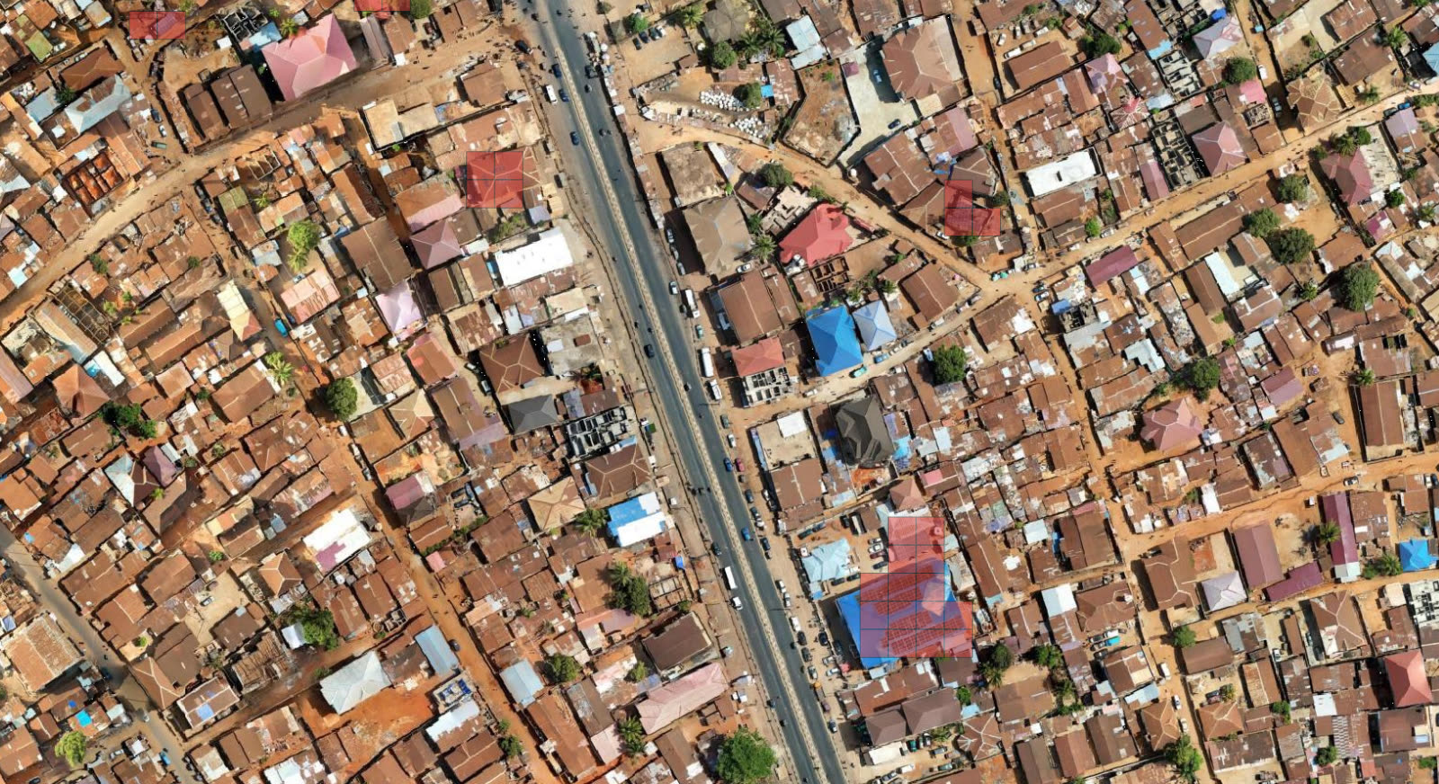
| Cells marked by at least 50% of volunteers | 152, on 73 tiles, all Single Feature |
The cells at 50% in QGIS, as in Label in QGIS:
Training data
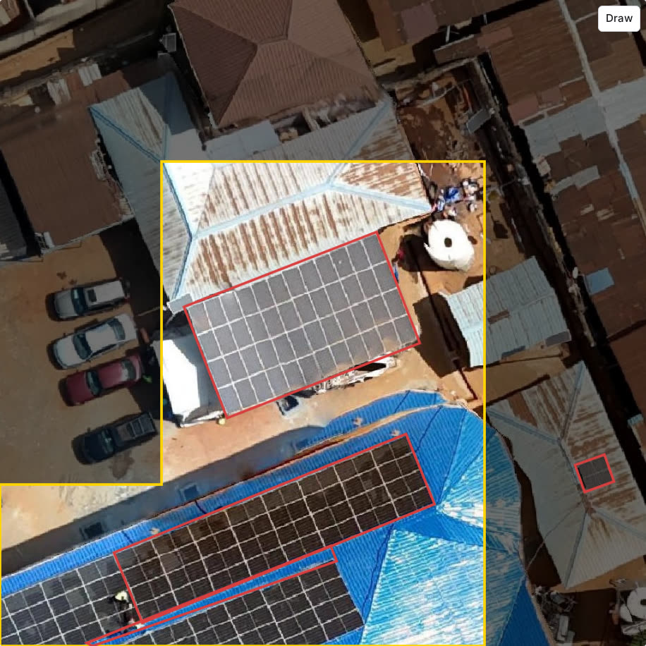
The auto labeller loads the same project at a 50% share and lists the 73 tiles. The dataset marks 36 solar panel arrays on 20 of those tiles: EdgeTAM found 32 from a tap or a drag, and 4 were drawn by hand. With Boxes, each box follows the angle of the array:
The README.md in the dataset has the tile URL and the steps to show labels.geojson over the imagery in QGIS.